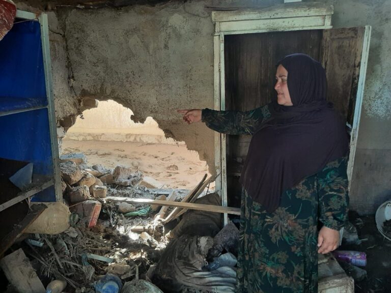


Basid, a village lying at 2,367 meters (elevation) in the valleys of the Pamir Mountains of the Gorno-Badakhshan Autonomous Region (GBAO) in Tajikistan, is just one of many settlements that is constantly at risk of natural disasters such as rockfalls, mudflows, and avalanches in the highly mountainous country, according to the Aga Khan Development Network (AKDN).
Niyozbek, the head of the village of Basid, noted, “I want to be relocated to a new place that is safe, and offers more opportunities for agriculture, water and pasture. Disasters such as earthquake, landslide, and flooding are frequent guests in our village and we cannot continue to live in fear….”
`When the 2015 earthquake hit and another disaster – the flooding of the Usoi dam on Lake Sarez – threatened Basid, the Aga Khan Agency for Habitat (AKAH), the Aga Khan Program for Islamic Architecture (AKPIA) at MIT (Massachusetts Institute of Technology) and US-based architectural practice KVA (Kennedy & Violich Architecture Ltd) reportedly swung into action, collaborating on employing technology and innovation to design a pathway for possible relocation of the village.
The methodology for the project drew on AKAH’s time-tested Habitat Planning Framework, including 3D drone imagery, in its community-based design approach, which identifies relocation and design alternatives that provide secure settlements for residents.
AKAH’s Head Office Lead, Habitat Planning and Innovation, Kira Intrator, reflects on this process and says, “We created a gradient of relocation design alternatives through rural design and habitat planning for the voluntary relocation of Basid village to a plateau identified by the community – which they call the Khabast or ‘Good Place’ – located approximately 300 meters above Basid village. We combined community-based input and vernacular design with geotechnical hazard analysis (which ranged from historical seismic activity to real-time 3D imaging) environmental, topographical, hydro-engineering and agro-economic mapping to assess site suitability and potential.”
Using settlement patterns from the satellite drone imagery captured by AKAH, the team was able to begin mapping relocation plans, which served as the foundation for their assessments on the ground in Basid. The results of the Basid project, conceptualized as Pamir Village Planning and Design for Disaster Mitigation, will serve as a useful case study for AKAH and its partners to draw upon as many villages in the area suffer a similar set of problems.
As Tohir Sabzaliyev, head of AKAH Tajikistan’s innovative Spatial Data Infrastructure (SDI) Unit explains, “Modern technology at hand such as UAV (Unmanned Aerial Vehicles) enabled us to do spatial analysis and derive critical information prior to the experts’ field visit. This case study particularly showed us that UAV can be used as solution for the on-demand acquisition of detailed images of an area of interest and the creation of detailed 3D models and orthophotos. We will continue to apply the same methods for other villages that are considered at very high risk due to natural hazards.”
With integrated design alternatives, the AKAH-MIT-KVA project team investigated all the highlighted aspects – infrastructural, environmental, and social – to arrive at their recommendations.
The project was offered a highly coveted spot in the architectural exhibition of the prestigious Venice Biennale 2021, which has just been postponed to May 22 to November 21, 2021.
AKAH continues to use drone technology in its disaster management efforts, deploying them to the mostly hard-to-reach and expansive areas to acquire the necessary data for disaster planning and response purposes.